
# 48825
THÉVENOT, Melchisédec (1620-1692)
Relations de divers voyages curieux,
$62,500.00 AUD
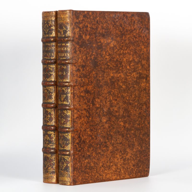
qui n’ont point esté publiees, ou qui ont esté traduites d’Hacluyt, de Purchas, & d’autres Voyageurs Anglois, Hollandois, Portugais, Allemands, Espagnols; et de quelques Persans, Arabes & autres Orientaux. Enrichies de Figures de Plantes non décrites, d’Animaux inconnus à l’Europe, et de Cartes Geographiques de Pays dont on n’a point encore donné de Cartes. Paris : Jacques Langlois, 1663-1664 [Sebastien Mabre-Cramoisy, 1666] [André Cramoisy, 1672]. Four parts in two volumes, folio, matching contemporary bindings of mottled calf, spines with raised bands tooled and lettered in gilt; marbled pastedowns and endpapers. Part 1. title-leaf in red and black, pp. [12], xxv, 1-52, 1-24, 17-26, 17-29, 26-31, 36-40, 1-12, 1-80, 1-30, 1-10, 19-24, 1-36, 1-56, with 4 folding maps (3 double-page), 2 folding double-page plates, 3 full-page plates and numerous smaller plates in the text. Part 2. title-leaf, pp. [9], 1-20, 1-60, 1-128, 1-40, 1-16, 1-44, 47-48, 1-4, 1-30, with 8 folding double-page plates (including 5 coastal profiles), 3 full-page plates, 3 smaller plates in the text, 1 folding map. Part 3. title-leaf, pp. [12], 31-68, 1-12, 1-28, 1-216 (frequent misnumbering), with 11 plates (3 double-page), 2 folding double-page maps. Part 4. title-leaf, pp. [2], 1-24, 1-14, 1-[24], 1-23, [blank], 1-24, 1-16, 1-16, 1-8, 1-4, [2], 1-45, [blank], 47-58, 1-40, with 2 small plates in the text, 46 woodcuts, and 2 folding maps.
The first edition of each of the first four parts of Thévenot’s monumental work.
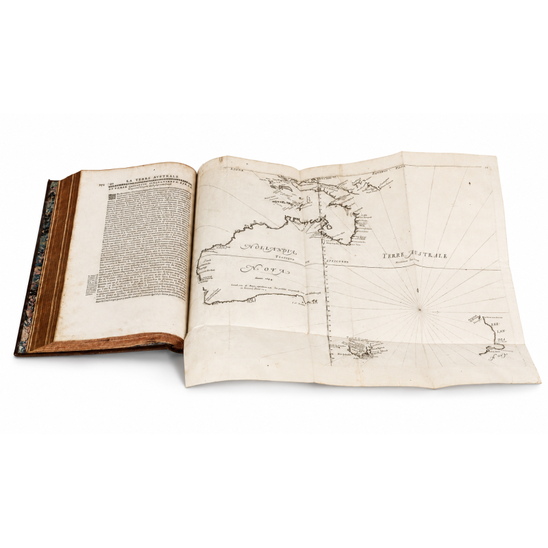
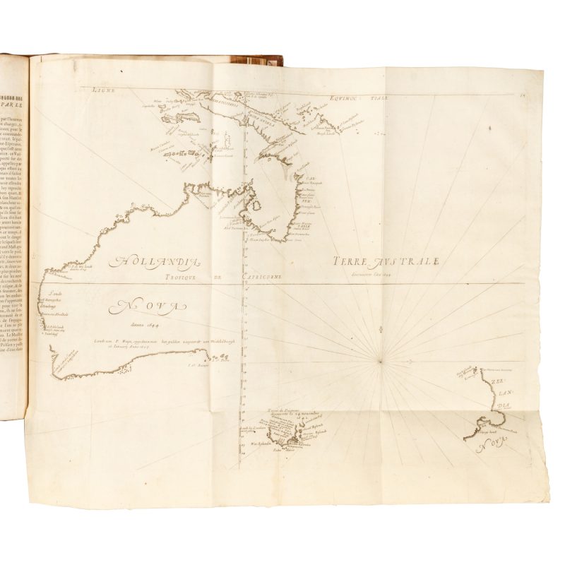
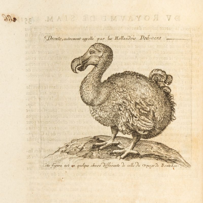
Amongst travel collections of the seventeenth century, Thévenot’s occupies a distinguished place, being one of the most complete and lavishly produced. Its scope includes Africa, the Far East, Southeast Asia, the Americas, Australia and other regions. The narrative of Abel Tasman on Australia is certainly one of the most significant and primary sources of information on the island continent. The collection is also of great American interest, containing Palafox’s study on the natives, Acarette du Biscay’s relation of La Plata, and Gage’s narrative, which includes an important passage on Mexico, and is profusely illustrated with full-page woodcuts. Asia and Africa are also well represented, with over half of the first volume being dedicated to these regions.
The work is illustrated with maps and views. The maps include the famous Tasman map of Australia (Hollandia Nova) in its fifth state (with rhumb lines and the Tropic of Capricorn, and ’19’ added at top right). The importance of this map can hardly be overstated: it is a cornerstone of Australian cartography, both as the earliest obtainable map of the region as well as the predominant depiction by which the West would know the island for about a century. Amongst the numerous other maps are one of Japan and Pegu (usually lacking) and charts of the Indies, China, Hindustan, and East Africa; the plates include depictions of costumes, plants, and architecture.
Thévenot’s work is an exceedingly difficult book to collate: “Bibliographers have expended great pains on the collation of the Thévenot collection” (Catalogue of the John Carter Brown Library, vol. III, 102); “Collection interessante, dont il est difficile de trouver des exemplaires complets” (Brunet). Thévenot’s collection was published in parts and over roughly 10 years, thus there are virtually no two copies alike. The first part went to the printer in 1663, the second and third in 1664 and 1666, and the fourth in 1672; a fifth part was being prepared at the time of Thévenot’s death, leaving the work uncompleted. Sabin’s note is very enlightening regarding this issue: “It will be understood from this that there really was only one edition of Thévenot, and as that edition was completed only in 1696, the issue bearing that year on its general title-page is ordinarily regarded as the standard for collation.” (JCBL)
Brunet, Manuel du Libraire et de L’ Amateur de Livres, V, pp. 810-13; Palau, 331563.


