
# 42897
GROSS, Alexander
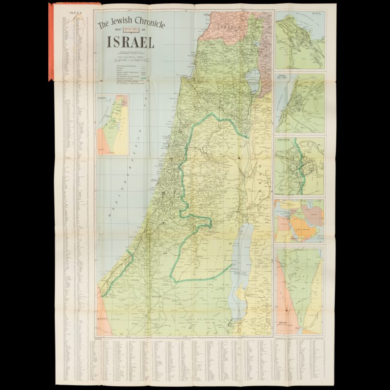
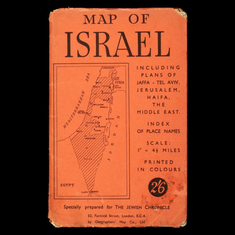
The Jewish Chronicle Map of Israel
$220.00 AUD
Cover title : Map of Israel, including plans of Jaffa – Tel Aviv, Jerusalem, Haifa, the Middle East. London : Geographers’ Map Co. for The Jewish Chronicle, November 1949. Map, printed in colour, 101 x 76 cms, folded and housed in lettered card wrappers (small tears to the corners, and at the point where the map is affixed to the wrappers, which have rubbed corners and a few stains), a very good example.
Rare and early map of Israel published by the London-based Jewish weekly newspaper The Jewish Chronicle (founded in 1841, the oldest continuously published Jewish newspaper in the world), shortly after the Declaration of Independence of the Jewish State of Israel on 14 May 1948, and its admission to the United Nations on 11 May 1949, displaying Jewish Settlements and international borders based on the 1949 Armistice Agreements, ‘subject to alteration and based on U. N. Security Council Official Records Ref. S/1302/Rev. 1. Dated 20th June, 1949’ (from the key).

