# 46572
DESNOS, Louis-Charles (1725 - 1805); NOLIN, Jean-Baptiste (1686-1762)
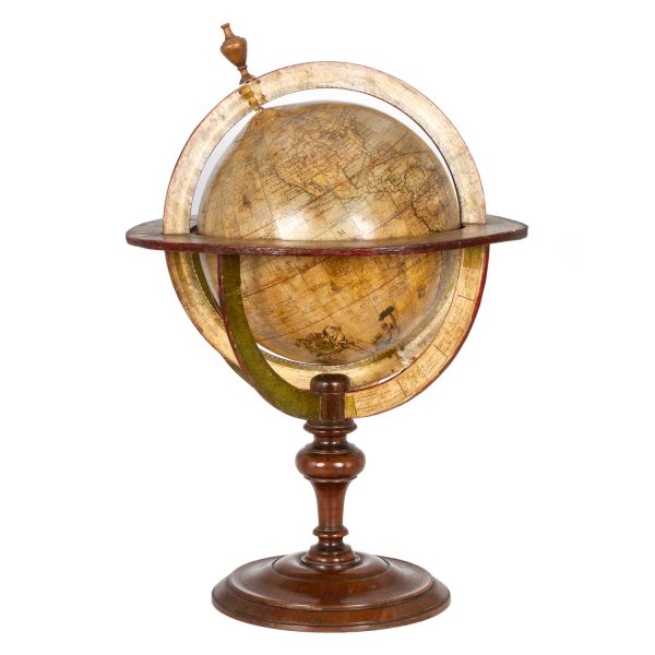
Globe terrestre
$45,000.00 AUD
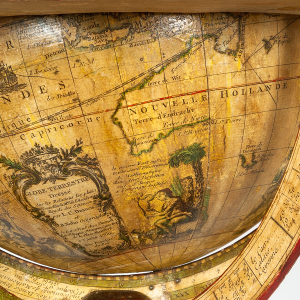
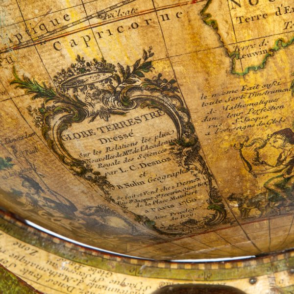
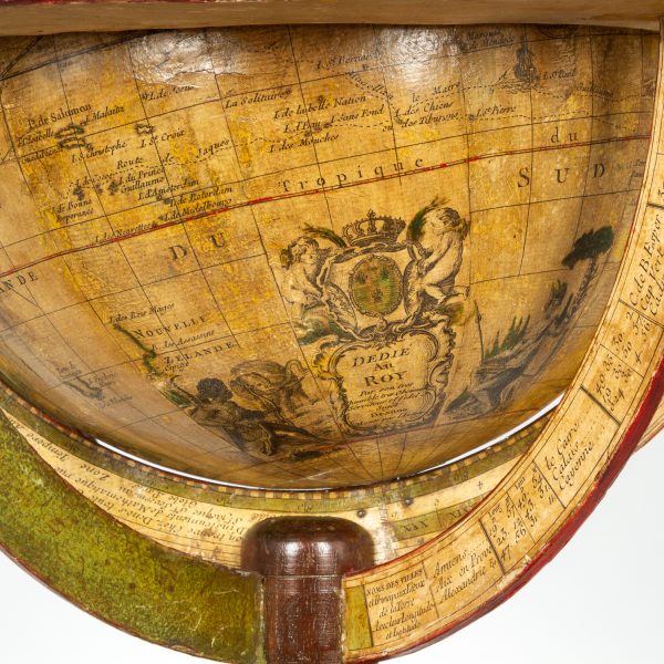
Dressé sur les Relations les plus nouvelles de Mrs. de l’Académie Royale des Sciences par L. C. Desnos et J. B. Nolin Géographe. Se fait et se vends chez Desnos, rue St. Jacque St. Severin, Quartier de la Place Maubert. Paris, 1760, avec privilége du Roy. Dedié au Roy, par son trés humble trés obéissant et fidel sujet Desnos et monté par lui.
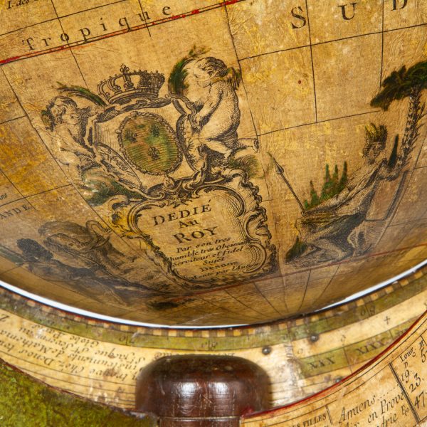
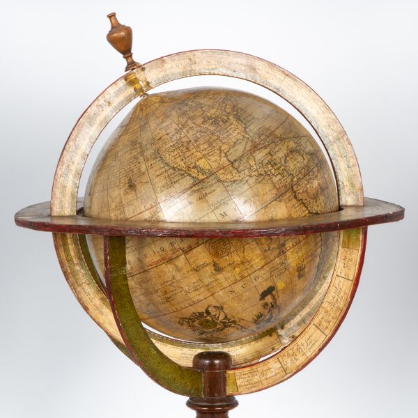
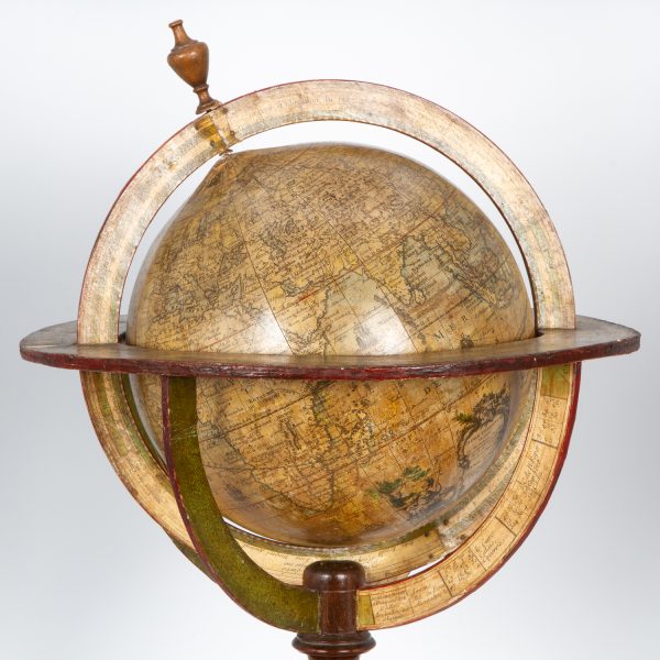
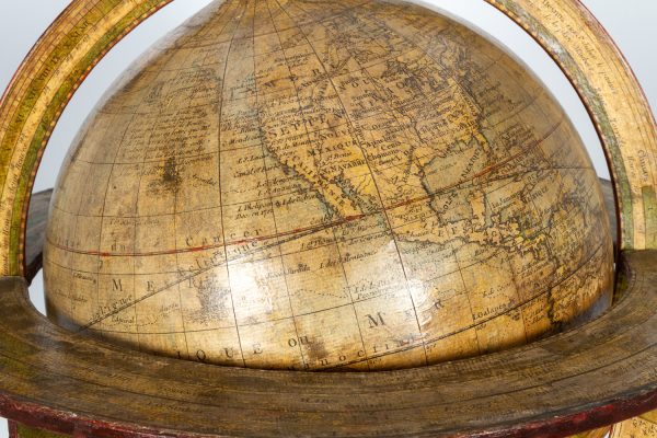
Terrestrial globe, 265 mm in diameter; engraved gores and two polar calottes with original hand-colouring over plaster base, a few old sealed tears without loss; graduated equator, tropics of Cancer and Capricorn, ecliptic and Premiere Meridian fixe de l’isle de fer (the prime meridian on the island of El Hierro which Louis XIII decreed in 1634); two cartouches (including the dedication to the King sometimes found removed during the French Revolution), decorative vignettes of exotic fauna and indigenous peoples, numerous engraved vignettes of maritime vessels, numerous coloured tracks of historical and contemporary explorers including Ferdinand Magellan, Jacob le Maire and Willem Schouten, Louis de l’Isle de la Croyere, Nicolas de Frondat, Aleksei Ilyich Chirikov, Jean-Baptiste Charles Bouvet de Lozier and Admiral George Anson; papier-mâché meridian ring with printed declination and elevation, engraved calendrical papier-mâché horizon ring with zodiac, edges painted red, supported on four papier-mâché quadrant arcs with the printed names of towns and their longitude and latitudes, turned wooden base and finial; total dimensions 600 mm high / 390 mm wide; a few discrete old signs of restoration, including at the North Pole; a fine example, with a warm patina, of this rare terrestrial globe.
A large and highly decorative French table globe from the mid-eighteenth century, rich in geographical detail that includes the voyages and discoveries of French, English, Dutch and Russian explorers.
This very rare globe shows the discoveries made in the Pacific by the early European expeditions, prior to those of Captain James Cook and the grands voyages of La Perouse, Baudin, Freycinet and Duperrey. Created during the reign of Louis XV by the partnership of Desnos and Nolin, two great mapmakers of the period, it is a tremendously evocative artefact from the Age of Enlightenment.
Louis-Charles Desnos (1725-1805) was one of the most prolific and influential map and globe makers of his age, at a time when Paris was the major centre for map production in Europe. He married the widow of Nicolas Hardy, the son of Jacques Hardy, a globe maker active in the years 1738-1745. Desnos acquired Hardy’s inventory and tools, and expanded the company further through the acquisition of the inventories of the Jaillot family and of Nicolas de Fer. Desnos would be appointed Royal Globemaker to King Christian VII of Denmark, and continued publishing throughout the late eighteenth century.
Jean-Baptiste Nolin (1686-1762) inherited the business of his father, the famous French cartographer, engraver, publisher and map dealer Jean-Baptiste Nolin (1657-1708).
This vividly illustrated and highly detailed terrestrial globe depicts the newly charted territory of Nouvelle Hollande as it was known from the most recent discoveries. The western coastline, as well as the partial coastlines of Van Diemen’s Land and New Zealand, are outlined based on the discoveries of the Dutch. Also marked are Dampier’s Passage, separating New Guinea from New Britain, and the island of Terre de S. Esprit (Australia del Espíritu Santo), the island in the New Hebrides originally mistaken by Quiros for the Australian Continent.
Collections:
The only globe by Desnos recorded in Australian public collections is in the National Gallery of Victoria, acquired from us in 2023.
Another example of this globe is held in Libraries and Archives Canada.
Provenance:
Jean R. Perrette, his bookplate pasted under the base of the globe.
Jean R. Perrette’s important collection of rare travel and exploration books was sold through Christie’s New York in 2016 (Sale 12259, Important Travel, Exploration, and Cartography, April 5, 2016). The globe is photographed in the catalogue in situ in Mr. Perrette’s Library.
Reference:
van der Krogt, Old globes in The Netherlands, 1984, pp. 104-105


