
Cartography
-

# 45628
BAUER FAMILY
A miniature terrestrial globe, circa 1830, showing Cook’s third voyage.
[Nuremberg : Bauer family, circa 1830]. Miniature terrestrial globe, two-and-a-half inches in diameter, original outline hand colouring, metal pins, housed in card box, the label on the lid with an image of a cartographer (the lower part of the case reconstructed); a fine copy signed MPS (the Bauer family). A charming early nineteenth-century terrestrial globe …
-
![[MAP OF MATRIMONY; AUSTRALIAN NATIVE BIRDS] A late Georgian-era album amicorum belonging to a London lady, with original drawings and poetry dating from 1832 to 1860.](https://douglasstewart.com.au/app/uploads/2024/10/2024_DSFB_5828-219x300.jpg)
# 45114
ROBINSON, Catharine
[MAP OF MATRIMONY; AUSTRALIAN NATIVE BIRDS] A late Georgian-era album amicorum belonging to a London lady, with original drawings and poetry dating from 1832 to 1860.
Quarto (245 x 200 mm), original luxurious binding of full leather elaborately embossed, both boards featuring a central cartouche with a depiction of the Roman goddess Luna in her chariot and holding torch, the spine with the word ‘ALBUM’ in gilt at the head; gilt dentelles, all edges gilt, original endpapers; pictorial title leaf engraved …
-
![[NORTHERN TERRITORY] Australian aeronautical map: Barrow Creek (Sheet F6)](https://douglasstewart.com.au/app/uploads/2024/10/2024_DSFB_5567-300x300.jpg)
# 45483
RAAF
[NORTHERN TERRITORY] Australian aeronautical map: Barrow Creek (Sheet F6)
[Canberra?] : RAAF Headquarters, 1944. “Reprinted August 1944, with minor amendments”. “For use in daylight or under red light”. Colour map, 48 x 70 cm. Equatorial scale 1:1,000,000; original folds, very slightly trimmed at right edge, otherwise very good.
-
![[QUEENSLAND] Australian aeronautical map: Cloncurry (Sheet F7)](https://douglasstewart.com.au/app/uploads/2024/10/2024_DSFB_5569-300x300.jpg)
# 45481
RAAF
[QUEENSLAND] Australian aeronautical map: Cloncurry (Sheet F7)
[Canberra?] : RAAF Headquarters, 1945. “Reprinted July 1945, with minor adjustments”. “For use in daylight or under red light”. Colour map, 48 x 70 cm. Equatorial scale 1:1,000,000; original folds, very slightly trimmed at right edge, a few minor stains in lower section, otherwise very good.
-
![[NORTHERN TERRITORY] Australian aeronautical map: Darwin (Sheet D6)](https://douglasstewart.com.au/app/uploads/2024/10/2024_DSFB_5565-300x300.jpg)
# 45482
RAAF
[NORTHERN TERRITORY] Australian aeronautical map: Darwin (Sheet D6)
[Canberra?] : RAAF Headquarters, 1945. “Reprinted June 1945, with major amendments”. “For use in daylight or under red light”. Colour map, 48 x 70 cm. Equatorial scale 1:1,000,000; one flight path marked in red pencil; original folds, very slightly trimmed at right edge, otherwise very good.
-
![[NEW SOUTH WALES] Australian aeronautical map: Bourke (Sheet H8)](https://douglasstewart.com.au/app/uploads/2024/10/2024_DSFB_5563-300x300.jpg)
# 45484
RAAF
[NEW SOUTH WALES] Australian aeronautical map: Bourke (Sheet H8)
[Canberra?] : RAAF Headquarters, 1945. “Reprinted June 1945, with minor amendments”. “For use in daylight or under red light”. Colour map, 48 x 70 cm. Equatorial scale 1:1,000,000; original folds, very slightly trimmed at right edge, otherwise very good.
-
![[CASED POCKET ATLAS; REVOLUTIONARY WAR]. [Almanach géographique ou petit atlas élémentaire ...]](https://douglasstewart.com.au/app/uploads/2024/01/2024_DSFB_0294-300x300.jpg)
# 42554
[DESNOS, Louis-Charles]
[CASED POCKET ATLAS; REVOLUTIONARY WAR]. [Almanach géographique ou petit atlas élémentaire …]
[Paris : Desnos, circa 1771]. Thirty-two copperplate engraved maps, each measuring 95 x 95 mm (image) and 115 x 115 mm (sheet), numbering in the upper right corner of each map; laid on linen, overall measurements 470 x 940 mm; inscribed verso Presented by the Marquis St. Simon to A. Gordon, with the initials M. G. (another …
-

# 43727
CARY, John (c. 1754 - 1835)
New celestial globe
[London] : J. & W. Cary, [between 1791 and 1820]. Celestial pocket globe, 3 1/2 inches in diameter, engraved gores over plaster and wooden sphere, two metal pins, housed in red morocco case lined with felt, bright original colour, some old discolouration under the varnish, metal eye hooks, the globe sitting perfectly within its case. …
-

# 44855
GOOS, Pieter
Pascaerte vande Zuyd-Zee tussche California, en Ilhas de Ladrones
Amsterdam : Pieter Goos, op’t Waater inde Vergulde Zeespiegel, 1666. 430 x 538 mm (image), 465 x 555 mm (sheet), had coloured, decorative cartouche, a fine example. A fine example of Pieter Goos’ sea chart of the Pacific Ocean. Extending from Van Diemen’s Land to Japan, and from New Zealand to California, it significantly notes discoveries …
-

# 44856
OTTENS, Reinier (1698 - 1750); de WIT, Frederik (1629 - 1706)
Magnum Mare del Zur cum Insula California. De Groote Zuyd-Zee en ‘t Eylandt California
Amsterdam : [R. & I. Ottens, 1745]. Copperplate engraving, 490 x 560 mm (image); 565 x 665 mm (sheet), hand coloured, small repair to tear in cartouche and a couple of pinholes, else fine. A striking example of Reiner and Joshua Ottens’ chart of the Pacific Ocean, an updated state of Frederick De Wit’s chart …
-

# 45014
GEORGE PHILIP & SON
Philips’ 12 inch terrestrial globe
London : George Philip & Son, circa 1928. Terrestrial globe 12 inches in diameter, printed gores over papier mache base, graduated equator band, supported on a contemporary half-meridian engraved brass stand on original turned wooden base and three feet, some old surface rubbing, a very good example, completely unrestored and in original condition. An interesting …
-
![[CARTOGRAPHY] John Coles, Royal Geographical Society map curator : signed letter to A. C. Macdonald of the Geographical Society of Australasia, re. the gift of a large map of New South Wales. April, 1885.](https://douglasstewart.com.au/app/uploads/2024/08/2024_DSFB_4730-300x300.jpg)
# 44840
COLES, John (1832-1910)
[CARTOGRAPHY] John Coles, Royal Geographical Society map curator : signed letter to A. C. Macdonald of the Geographical Society of Australasia, re. the gift of a large map of New South Wales. April, 1885.
Manuscript in ink, 1 page, small quarto (230 x 180 mm), on the letterhead of the RGS, London; dated 11 April 1885, the letter is addressed to ‘A. C. Macdonald Esq., Melbourne’; written in a secretarial hand, but with the autograph signature at the foot of ‘John Coles, Map Curator, RGS’; some off-setting and light …
-

# 45331
DEKKER, Elly and VAN DER KROGT, Peter
Globes from the Western world
London : Zwemmer, 1993. Quarto, boards in dustjacket, pp. 183, illustrated. A superb reference book on antique globes.
-

# 44804
Malaya 1948
Survey Dept. Malayan Union No. 15, 1948 Large scale separately issued map printed in colour, 910 x 635 mm, old folds, inset map of Langkawi Islands, lightly handled, very good condition. Detailed map of the Malayan Peninsula during the short lived period of the Malayan Union (1946 – 1948), which saw the Federated Malay States, …
-

# 44738
WISDOM, Joseph
The A to Z of Regency London
Introduction by Paul Laxton. London : London Topographical Society, 1985. Publication No. 131. Folio, boards in dustjacket, pp. xvi; 116, with detailed maps of Georgian London.
-
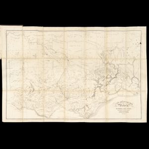
# 42518
HAM, Thomas
The squatting map of Victoria
Also titled: Squatters’ directory, road guide, and key to the squatting map of Victoria. Melbourne : Blundell and Ford, 1864-1865 [map published 1864; directory 1865]. Folding map, 464 x 705 mm, folded to 180 x 120 mm, linen backed, in original brown cloth boards with gilt lettering to front,190 x 130 mm, the map attached …