
# 46762
FAR EASTERN REVIEW
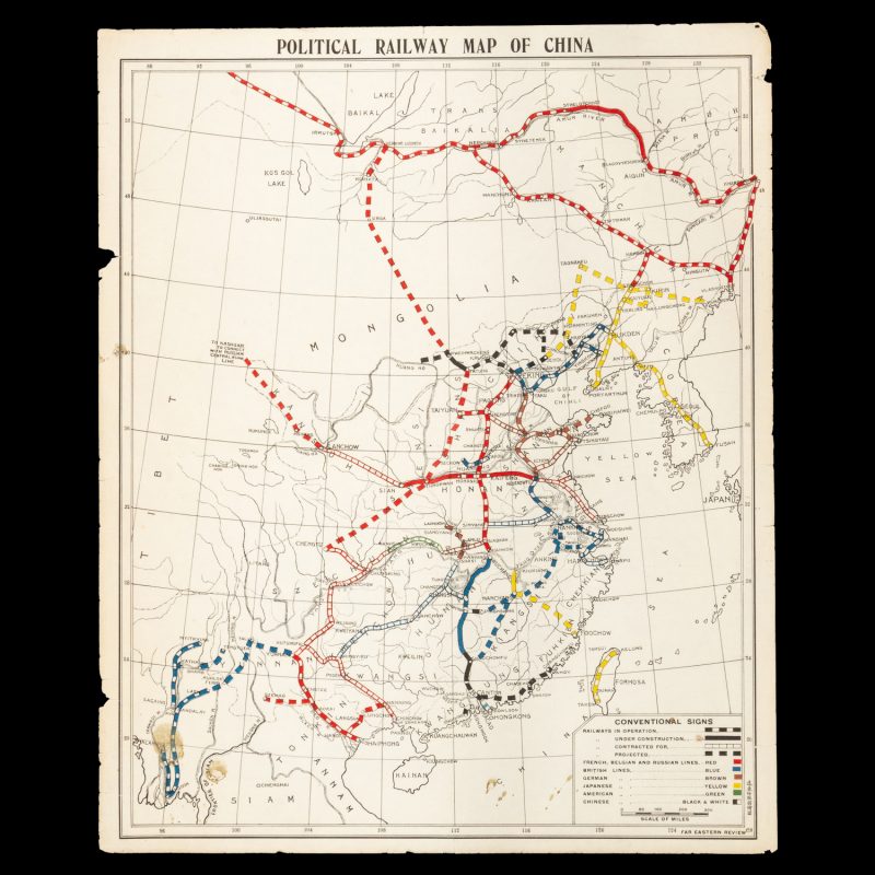
Political railway map of China
$1,500.00 AUD
[Shanghai] : Far Eastern Review, circa 1914. Map, printed in colour, 520 x 425 mm (sheet), a couple of small chips and edges and small stains lower left, showing the railways of China which are operational, under construction, contracted for, and projected, under French, Belgian, Russian, British, German, Japanese, American and Chinese control. The train lines extend down to Rangoon, Kowloon (Hong Kong), Foochow, Ningpo, Tsingtau, Fusan (Korea), Vladivostok, Irkutsk, and Lanchow on to Kashgar.
China’s interest in rapid development following its defeat in the First Sino-Japanese War saw the granting of concessions to foreign powers to build railways bringing trade to their spheres of influence. In the first decade of the twentieth century over 9,000 miles of railway were built, linking European colonial powers to their southern dominions and port cities, Americans to their trading cities, and Japanese and Russian interests to the north.
A very good copy of a scarce geopolitical map of China.

